On Friday morning, April 27th, Sam and I got up a little later than my parents. They were up at their normal Ohio time, but Utah is in the Mountain time zone. They went into the park ahead of us after eating breakfast somewhere. Sam and I ate breakfast at the Sol Cafe at the entrance to the park and bought roast beef sandwiches to eat on the trail for lunch.
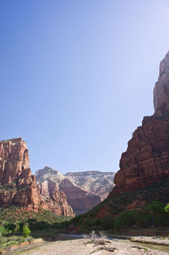
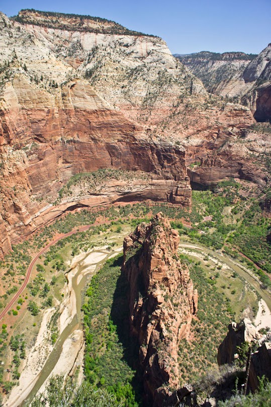
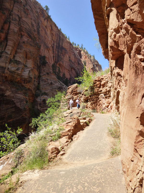
Our goal for day 1 was to conquer Angel’s Landing, one of the most strenuous and dangerous public hikes in the park. In the photo above you can see the Virgin River at the bottom and the peak of Angel’s Landing at the upper left. Before getting to the final ascent you have to hike about two miles up from the canyon floor on fairly steep trails carved into the mountain, then walk through a “valley” between two mountains.


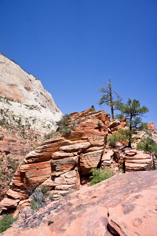
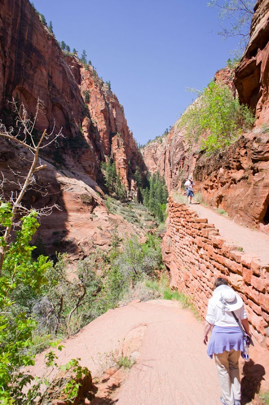
Afterwards the final trek to Scout’s Lookout is a Lombard Street looking series of 21 switchbacks called “Walter’s Wiggles.”

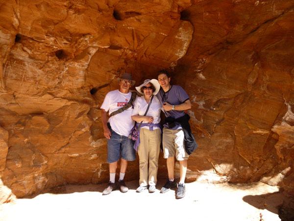
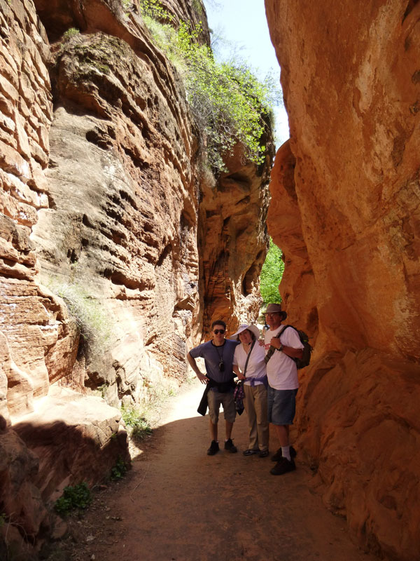
Thankfully the park has installed outhouses at Scout’s Lookout, which is where the below photo was taken.

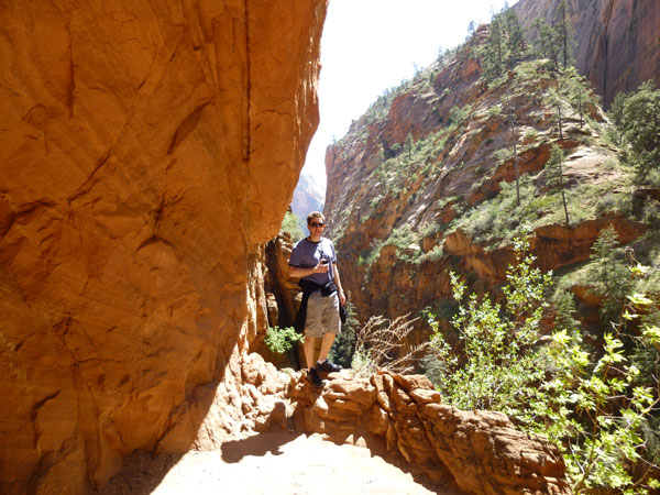
Scout’s Lookout also includes a sheer cliff hike where you’re only chance of survival is clinging to the chain going up the cliff, as seen below. This isn’t quite as dangerous as the ascent to Angel’s Landing’s peak, but it is a warning of the dangers to come if one is so inclined to go “all the way” to the end of the trail. There are very ominous warnings about six people falling to their deaths on the final ascent since 2004, and this chained climb is your final barometer to gauge whether you’re fit to go the distance. We met my father coming down the chain, he had chosen to refrain from making the final ascent while my mother surprisingly soldiered on alone.

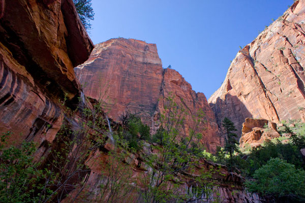
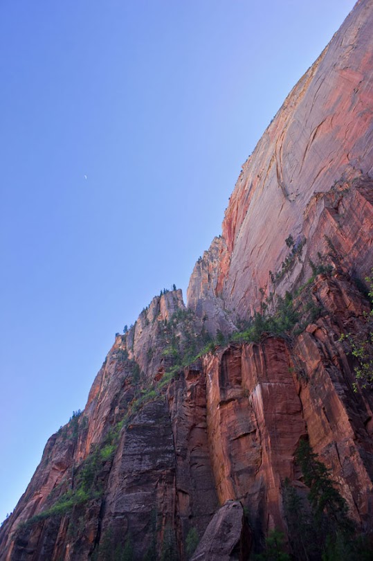
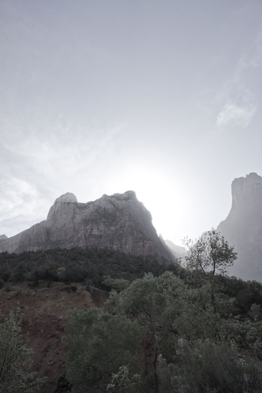
After climbing the chain you’re greeted with a clear view of Angel’s Landing. The final ascent goes along the narrow ridge you can see in the photo below.

Sam chose to stay at that point and wait for me to return.
There are plenty of desert chipmunks to entertain the waiting folks at Scout’s Lookout.

Below is a zoomed in photo of me hiking up the narrow trail to the top.

Shortly after this I met my mother coming back down from the top.

Below is my view looking back at where Sam was sitting.
View of the ascent looking back.

On either side there is often a sheer drop off to the bottom of the canyon thousands of feet below.

Sometimes there is a chain to hold on to as you steady yourself, sometimes not.

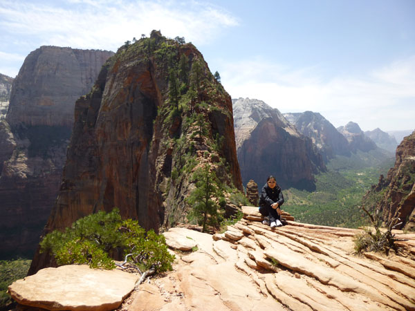
Once reaching the top the final eighth of a mile or so is an easy (although still dangerous) walk along the flattened top of the peak.


Below is a shot from the peak looking down on “big bend” below.
Apparently “don’t look down” is actually bad advice for me. I felt really nervous hiking the narrow path going up looking into the sky feeling the wind rush over me. Coming down looking down into the canyon I was passing people by and hopping my way down the path, often ignoring the chains altogether.

Below is a picture Sam took of me at the narrowest (and probably scariest) portion of the trail. This “bridge” has nothing on either side but a drop down into the canyon and one chain to hold onto. In the photo below I was politely waiting for some hikers to pass by. You can’t actually see the “bridge” in the photo, it is a single rock about 25 feet long and four feet wide.

The below video is a short but good sample of what it’s like (the real hike to the top takes maybe 30-45 minutes).
One of the panning shots at the beginning of the video is taken from one of the surrounding mountains, the trail that leads to Hidden Canyon. More about that one later (we hiked it on Sunday).
Back at Scout’s Lookout we regrouped and ate some food before heading back down the same trail we’d come up.


As we went back down the trail, specifically in the switchbacks, I started to experience pain on the sides of my knees. Sam related she was having the same feeling. I’ve never had joint problems before, but I guess this just means I’m getting older. My knee pain would be a constant problem for the rest of the trip and on 2 of the 3 days I ended up taking pain killers. My theory is that I blew something when I was jumping down the perilous Angel’s Landing descent and my adrenaline was too strong to notice. I hadn’t hiked or climbed since we went up the stairs in Griffith Park with Cindy a few weeks ago, and before that it had been even longer. I rarely play raquetball anymore either, so my knees weren’t used to so much jostling from jumping.
After getting back to the Grotto (beginning of Angel’s Landing trail) we hopped on the park bus and rode it in the loop until we came back to the Lodge stop.

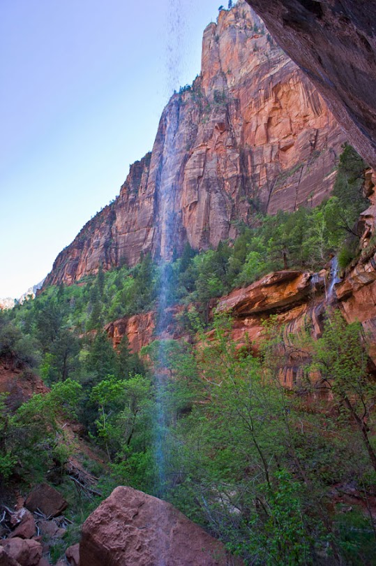
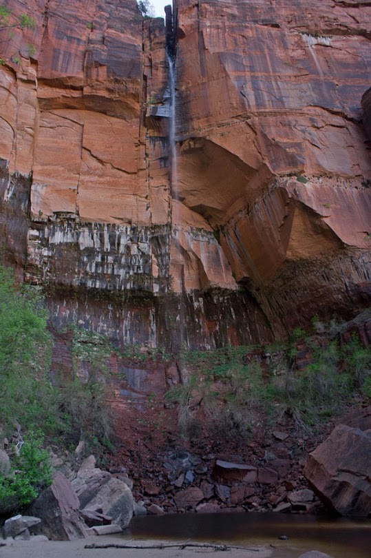
From the Lodge we hiked to Emerald Pools. After going to Angel’s Landing this was not as spectacular as we imagined. The waterfalls were little more than a trickle.

The crew was tired, so they stopped at the middle falls. I didn’t want to miss the upper falls though, so I soldiered on up the path another twenty minutes or so (a one mile hike round trip).

In the photo below you can see the upper Emerald Pool and waterfall. It’s really little more than just mist spouting off the top. It’s like a much larger version of the little waterfall and pool in Malibu.

On the way back down to the bus stop there was a narrow place where I climbed up and Sam took a picture.

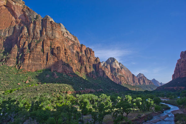
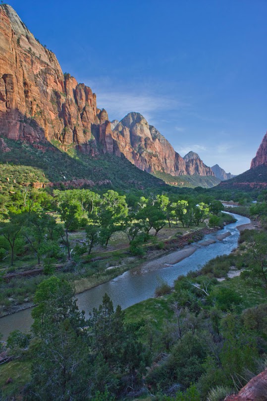
As we continued down to the Grotto we kept stopping as every clearing had an even clearer and more breathtaking view.


The two shots below were taken from the bus window heading back to the entrance of the park.

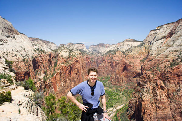
At the main entrance to the park there is a 3D topographical map of the park. I’m pointing to Angel’s Landing.

